

Weather Alert Map USA app for iPhone and iPad
Developer: Elecont LLC
First release : 25 Nov 2012
App size: 81.29 Mb
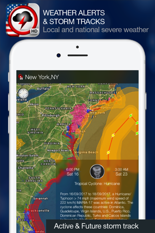
Weather Alert Map is the only app you need for the latest severe weather information. Get the latest Severe Weather Warnings, Watches, Advisories using instant PUSH technology, check radar images and storm tracks, view historical climate details so you’re always aware of weather on the way! Check LIVE storm track, future path and get critical weather alerts for your location in easy and intuitive way - directly on the map.
Alerts:
* Pushes notifications for severe weather at multiple locations you choose.
* Shows various weather alerts on a map with color-coding for easy identification. (e.g., tornado warnings, flood advisories)
* Provides details and summaries of alerts when you tap on them.
* Covers a wide range of weather events including blizzards, earthquakes, hurricanes, and more.
Weather Tracking:
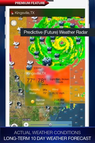
* Displays animated weather radar for your current location and lets you see past, present, and future radar images.
* Offers high-resolution radar images for clear visuals.
* Shows national and regional satellite images for cloud cover.
Additional Features:
* 10-day and hourly weather forecasts for various locations worldwide.
* Current weather conditions displayed on the map.
* Lightning tracker showing live and recent lightning strikes in your area.
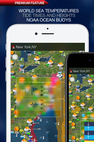
* Sea surface temperature information for ocean enthusiasts.
* Tide predictions for coastal locations around the world.
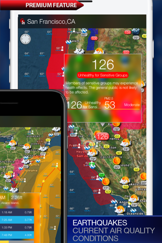
* Air quality index (AQI) for the US, including data on fine particles and ozone.
* Earthquake updates with a real-time map showing recent earthquakes and their strength.